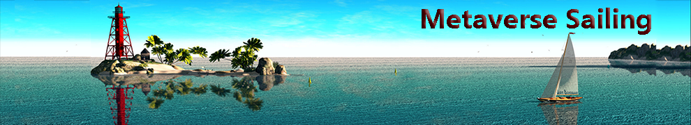
Most of planet Earth is covered by water, and a good deal of commercial and personal traffic takes place over the navigable waterways world-wide. For thousands of years sailors have used nautical charts of these waterways for safe and orderly travel between distant waypoints. The charts show the countour of the ocean floor and depth sounding for the area covered, as well as the locations of maintained navigation channels, shipping lanes, and known hazards.

A standardized set of visual markers is an essential part of that system, and both lighthouses and fixed navigational buoys are not only the ‘traffic signs’ of the seas, they are also part of national and global cultural heritage. The Alexandia Lighthouse, for a simple example, is invariably listed in schoolbooks as a Great Wonder of the Ancient World alongside the Egyptian pyramids.

In the United States, the US Coast Guard is responsible for maintaining the U.S. Aids to Navigation System (ATON) of official navigational markers that define coastal waterways. The Coast Guard has major educational initiatives to teach new sailors how to interpret the visual patterns of nav buoys and to update the Old Salt skippers about any changes in the marker grid system.

There are many public and private resources online where boaters can learn about national and international navigation markers and how they can best use it. Here’s a quck flash animation in case you’re interested but have an attention deficit.
To my knowledge, at the present time there is no such system of navigation buoys in Second Life. I recall discussing it over two years ago with RJ Kikuchiyo in his SL Coast Guard official role. We both wondered if it was feasible to use standardized navigational markers in SL waterways and generate charts that would be familiar to sailors in RL or SL. It was an interesting idea, but frankly two years ago It was pretty unusual to sail or race in regions that had more than a handful of sims, so a navigational chart system seemed pretty unnecessary.
Well, in two years a lot has changed. Many sailors are now doing extended cruises to regions and even whole continents they’ve never seen before, trying to chart new passages and share the information. Here’s a chart of Anu Daviau’s recent great exploration of mainland waterways that began at Schiffsratten Yacht Club in United Sailing Sims, went up the East and north Coast of Nautilus, then across the northern intercontinental waterway that links Nautilus to Corsica. She then looped around Corsica and Gaeta, returning along the West coast of Nautilus ultil she finally ran out of water. In total she covered 573 sims. Chaos Mandelbrot and IAttempted a similar adventure that I discussed here.

It looks like that’s just the tip of the iceberg; Cristalle Karami is putting together a map hud for long-distance cruising and EastTuesday Borel discussed publishing his maps and others in an SL book format. And don’t let me forget the Mowry Bay Cruising Club that’s grown very rapidly over the past couple They set sail every Tuesday evening, navigating to new and exotic destinations.
A common thread among many of these sailors is the need for navigational aids that parallel what vessels use in the real world. All sailors would benefit from a system of fixed navigational markers on popular waterways in SL that matches the RL system. If I were youreading this, I’d besaying to myself “That sounds nice, Jane, but there must be a thousand problems. There are buoys everyplace and an incredible number of Sims, who is going to do this… No way, José.”
Well, maybe you’re right. But remember, we’re only talking about navigational buoys, which might add up to 0-2 markers in each high-traffic water sim. we also already have RL international standards and extensive educational tools.
Is RL not good enough? You want standards and education in Second Life? (I was hoping you’d ask that!) The Second Life Coast Guard has complete sets of wonderful, accurately detailed navigational buoys that they offer free to any and all interested parties. Sanstrom Laxness’ SLCG group knows what they’re doing and they have the real life experience and credibility to back it up. Education about Coast Guard issues and water safety is one of their primary goals, and I’m quite certain all the yacht clubs would join with SLCG to provide the necessary education, advice, and potential maintenance for any nav buoy system.

“What happens if this is successful?” you might think; “You could end up with dozens… hundreds… of buoys to monitor in order to keep the charts accurate. Things change pretty quickly around here.”
Well, as I mentioned, although navigational buoys are critically important aids to ships at sea, there are relatively few of them, and the whole intention is to keep their position fixed. They are the reliable reference, the true waypoint for all the fragile craft tossed by offshore wind and wave. It would be relatively easy to insert a script in SL nav buoys that every few days sent an email reminder of the buoy’s location. A couple prim SLCG-approved, free buoy that meets international standards, and a single very infrequent script message. That’s all it takes.

The buoy would then talk to a simple map grid, flashing a few pixels to herald its presence at a tiny spot in a busy sim-sealane far away. With even a momentary glance at such a map, any SL sailor would relax, smile and rest assured. They’d know where they were and have a beacon to guide them. They’d be as firmly planted in this Second Life as any other.
A scripted buoy in SL that announces its location is certainly not a new idea. Last year Mothgirl Dibou and Cynthia Centaur lead an online ad-hoc discussion thread at SLSailing.org concerning consensus protocols for sailboats. A summary of the ideas discussed in the open thread are included on the SL Sailing Wiki. It includes a protocol for communication between buoys and boats in a sailboat race:
Communication between boat and buoys
Each mark should broadcast its position to all boats in the neighbourhood using llShout on channel -8001 every 3 seconds. This way, boats that are competing in a race can use this information together with their own position and the positions of the other boats to implement ROW indication within the 2 shiplengths zone.
The message format is:
message type, (value = “Buoy”)
x coordinate (global x coordinate),
y coordinate (global y coordinate),
buoy name
This ad-hoc protocol is used in Yuu Nakamichi’s tetrahedral buoys in Blake Sea. Certain race rules decisions depend on whether a boat is within two boat lengths of the mark, and this script protocol could facilitate that determination.
While it may be good for racing, however, this kind of scripted buoy is not appropriate as a navigation marker. That’s no surprise; they weren’t designed for navigation, they were designed for racing. The navigational buoys should be more simple to construct.
Is such a navigation buoy a big deal, however ?
Well, I think to a sailor it is. I’m bringing it up because navigational aids are part of our history, art, culture and experience. It’s how we plied the oceans and made sense of the world around us.
Maybe its how some of us make personal sense too. Years ago when I was an “Opti kid” I’d go on overnight cruises with family and friends. In the middle of the night, those choppy waves and shifting gusts can prove pretty scary, particularly if you’re a kid with a type-A personality, spending much of the transit questioning your parents’ navigational expertise.
I’d sit there unblinking, gaze solemnly fixed on the blackness ahead, trying to convince myself the horizon was indeed still out there. in reality,I was waiting until I could see a distant light, a fixed beacon I had memorized. It made no difference what any of the instruments showed. Numbers can lie. Show me the real thing. When that light appeared way off in the distance, a pinpoint in a sea and sky of black, I knew I had my bearings, and I cajoled the adults to give me the helm.
I had my lit beacon; I knew where I was, and where I was going. I could use that beacon and bring everyone home.
I think many sailors feel the same way In second life. A simple pattern of navigation buoys Would substantially enhance the reality of the SL sailing emulation for cruising sailboats. it would also provide a simple focus for collaboration between different groups and different regions, drawing on the skills and expertise of sailors, Coast Guard, and teachers.
I think the time has come for a nav buoy system in SL, but I would very much appreciate people’s views on the issue so we can come up with detailed recommendations for a system that meets eveyone’s needs.


 This simple truth is acknowledged each year in Second Life by a Day of Remembrance, when a series of events are held to record and celebrate the friends and loved ones that have given us so much, but are now gone.


